
TL;DR

Get business pricing on tech for your team
- Business-only prices and quantity discounts
- Tax-exempt purchasing
- Multiple users, one account, clear invoices
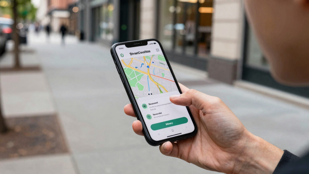
StreetComplete is a mobile app that allows users to contribute small, targeted updates to OpenStreetMap via simple questions. This approach aims to improve map accuracy and coverage by engaging a broad user base in tiny, manageable edits.
StreetComplete is a mobile application that enables users to contribute small, targeted updates to OpenStreetMap through simple, question-based tasks. The app’s approach aims to engage a broad community of contributors by making editing accessible and manageable, thereby improving map accuracy and coverage.
The app was officially released in 2019 and has gained popularity among both casual users and dedicated mappers. It functions by presenting users with small ‘quests,’ such as confirming the name of a street, adding missing information about amenities, or updating road types. These quests are designed to be quick and easy to complete, lowering barriers for participation.
According to the developers, StreetComplete has contributed thousands of small edits to OpenStreetMap, especially in areas with limited existing data. The app integrates directly with OpenStreetMap’s editing platform, allowing contributions to be uploaded seamlessly once a quest is completed. The initiative has been praised for its simplicity and its potential to democratize map editing, making it accessible to non-experts.
Impact of Tiny Edits on OpenStreetMap Data Quality
StreetComplete’s approach to map editing emphasizes incremental contributions, which collectively can significantly enhance data accuracy and completeness. By lowering the entry barrier for contributions, it encourages wider participation, including from volunteers who might not have technical mapping skills.
This method also helps to keep map data current, especially in rapidly changing environments or underserved regions. The app’s success demonstrates how small, manageable tasks can play a vital role in maintaining a high-quality open data resource like OpenStreetMap, impacting industries, navigation services, and local planning.
As an affiliate, we earn on qualifying purchases.
Background and Growth of Quest-Based Mapping Tools
OpenStreetMap has long relied on volunteer contributions to build a comprehensive global map. However, the process of editing can be complex and intimidating for newcomers, limiting participation. In recent years, various tools and apps have been developed to simplify editing, with StreetComplete emerging as a prominent example.
Since its launch, StreetComplete has been adopted by a growing user base, especially in regions where official mapping efforts are limited. Its quest-based model aligns with gamification trends and has been compared to other citizen science initiatives. The app’s development was driven by the need for more frequent, smaller updates that can be completed quickly, encouraging continuous improvement of map data.
“Our goal was to make editing OpenStreetMap as simple as answering a few questions. Small contributions add up to a more accurate map.”
— Maximilian Klein, developer of StreetComplete
As an affiliate, we earn on qualifying purchases.
Unconfirmed Impact and Future Adoption Challenges
While initial data suggests that StreetComplete has successfully increased contributions, it is not yet clear how much these small edits improve overall data quality in the long term. The extent of user engagement in different regions and the app’s ability to sustain growth remain uncertain.
Additionally, questions remain about how the platform will adapt to potential challenges such as data vandalism, quality control, and integration with other mapping tools.
As an affiliate, we earn on qualifying purchases.
Next Steps for Enhancing and Expanding StreetComplete
Developers plan to introduce new quest types and improve user interface features to attract more contributors. There is also ongoing collaboration with local communities and organizations to target underserved regions.
Monitoring the impact of these efforts, along with gathering user feedback, will determine how widely the tool is adopted and how effectively it can contribute to the global OpenStreetMap dataset in the coming years.
As an affiliate, we earn on qualifying purchases.
Key Questions
How does StreetComplete differ from traditional map editing?
StreetComplete simplifies editing by presenting users with small, specific questions rather than requiring comprehensive map edits, making participation easier for non-experts.
Can anyone use StreetComplete to contribute to OpenStreetMap?
Yes, the app is designed for general users, requiring no prior mapping experience, and is available on common mobile platforms.
What types of updates can users make with StreetComplete?
Users can confirm or add information such as street names, road types, amenities, and other geographic details through simple quests.
How does StreetComplete ensure data quality?
Contributions are reviewed by the community and integrated directly into OpenStreetMap. The app also encourages multiple confirmations for accuracy.
What are the limitations of the quest-based approach?
While effective for small updates, complex edits still require traditional mapping tools, and the quality of contributions depends on user engagement and accuracy.
Source: hn
Halloween Picks
halloween
As an affiliate, we earn on qualifying purchases.